
Interactive Part 77 Surface Mapping
Stay compliant, improve safety, and make better decisions with FAA-defined interactive maps tailored to your airport.
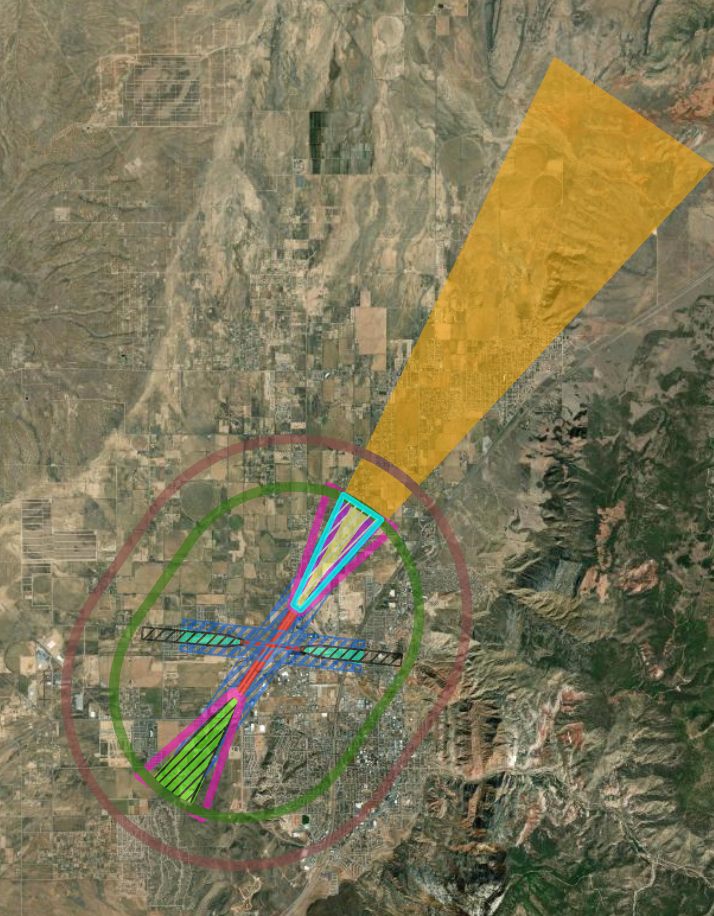
Understanding FAA Part 77 Surfaces
FAA Part 77 establishes the standards for determining obstructions to navigable airspace. These imaginary surfaces — including primary, transitional, horizontal, conical, and approach surfaces — are essential for evaluating safety and the impact of proposed construction and natural growth near airports. Our interactive maps make these complex surfaces easy to visualize, measure, and use in day-to-day decision-making.

Designed for Airport Professionals
Airport Managers & Operations Specialists – simplify compliance reviews and inspections.
Planning & Engineering Teams – evaluate proposed development quickly and accurately.
Consultants & Contractors – communicate with stakeholders using clear, visual data.
Why Choose an Interactive GIS Map?
📍 Instant Visualization – layered, user-friendly maps.
📏 Measurement Tools – quickly check object heights and distances.
🔎 Real-Time Decision Support – identify potential obstructions early.
🔄 Collaboration – share secure links with stakeholders.
Updated Orthomosaic & Drone Data Integration (Coming Soon)
AirSafe Measurements will soon offer regular drone imagery updates for airports, creating up-to-date orthomosaics tied directly into your interactive Part 77 maps.


Why AirSafe Measurements?
With over 10 years of direct experience in airfield operations, we understand what makes your job easier and safer. Our Part 77 mapping services are designed with practical airport needs in mind — not just compliance, but real-world efficiency.


Ready to Elevate Your Airport’s Safety & Compliance?
Contact us today to learn more about our interactive Part 77 mapping services.
Disclaimer: These maps are for informational and planning purposes only and are not FAA-certified engineering documents.